


Introduction à cartographier les couches
Les couches de carte sont des aspects cruciaux dans les applications de cartographie qui permettent aux utilisateurs d'imaginer et de communiquer avec divers types d'informations géographiques. À leur base, Les couches de carte permettent le mélange de plusieurs mesures d'informations, Amélioration de l'expérience globale de la navigation et de la compréhension des connexions spatiales. En superposant divers ensembles d'informations, Les utilisateurs peuvent obtenir des compréhensions qui resteraient certainement cachées si les informations étaient fournies en isolement.
Divers types de couches de carte offrent des fonctions uniques; par exemple, Une vue par satellite fournit une représentation photo de la surface de la Terre, Permettre aux utilisateurs de voir des fonctionnalités géographiques dans leur forme entièrement naturelle. D'autre part, Une couche de vue sur la route offre un point de vue à 360 degrés à partir de sites spécifiques sur la carte, Permettre une expédition en ligne de routes et de structures. En outre, L'intégration d'une couche de trafic peut être importante, Comme il affiche des problèmes de trafic en temps réel, Aider les utilisateurs à éviter les emplacements congestionnés et à améliorer l'efficacité de la planification des chemins.
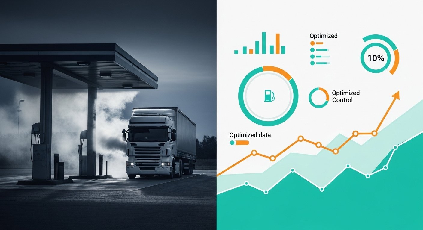
L'importance de ces couches est encore améliorée par les développements technologiques, comme le système de surveillance GPS ProTrack, qui utilise des performances avancées comme la superposition du trafic en direct pour fournir aux utilisateurs des informations mises à jour concernant le flux de trafic. Cette communication dynamique entre les couches améliore non seulement l'expérience utilisateur, mais aide également de manière significative dans les processus décisionnels liés à la navigation et à la logistique.
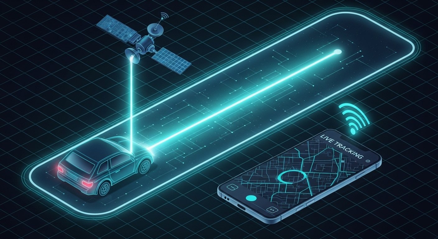
Les couches de carte ont facilité l'incorporation de fonctionnalités essentielles, comme les capacités de tracker GPS, qui sont cruciaux pour la surveillance des lieux dans diverses applications, Composé de l'application ProTrack365. Les utilisateurs peuvent accéder à des mises à jour en temps réel, permettant une surveillance et une compréhension plus précises de leur environnement. Ainsi, Il est essentiel de comprendre l'idée des couches de carte pour toute personne qui cherche à utiliser efficacement les applications de cartographie, Alors qu'il définit la structure pour explorer comment ces différentes couches ont un impact sur nos expériences de navigation.
Couches satellites: Une vue de l'oiseau
Les couches de carte satellite offrent un point de vue aérien étendu de la surface de la Terre, un appareil important dans divers domaines tels que l'emplacement, planification métropolitaine, et surveillance écologique. Ces couches sont basées sur des images haute résolution capturées par des satellites en orbite autour de la planète, qui utilisent une technologie complexe pour collecter des informations à partir de diverses altitudes et angles. Cette technologie permet la collection d'images multispectrales, permettant la visualisation des paysages au-delà de ce que l'œil nu peut voir, Composé de santé et de bien-être de verdure, variantes topographiques, et saupoudrer des corps.
Les avantages de l'utilisation de la carte satellite vuent beaucoup. Pour les circonstances, Les coordinateurs métropolitains peuvent évaluer les modèles d'utilisation des terres, changements de zonage, et les densités de population, des choix proéminent à plus éclairé concernant le développement des installations. Les chercheurs écologiques utilisent des images satellites dans la surveillance des changements dans la couverture terrestre et repérer les catastrophes entièrement naturelles, Ayant ainsi un rôle crucial dans la gestion des catastrophes. En outre, Les informations provenant des couches satellites peuvent être incorporées avec diverses applications, Composé du système de surveillance GPS ProTrack, qui améliore la logistique et fournit la gestion de la chaîne par évaluation spatiale.
Les solutions qui utilisent les couches satellites sont composées de Google Planet, qui permet aux utilisateurs d'explorer les images globales et la surface, et des appareils spécifiques tels que l'application ProTrack365, qui offre des vues de satellite améliorées combinées à des informations en temps réel. Ces applications montrent l'énergie des couches satellites, en particulier dans les situations où des informations géographiques détaillées sont essentielles, comme tout au long des initiatives de réaction de la situation d'urgence ou des emplois de développement métropolitain. Dans l'ensemble, L'intégration des couches satellites améliore notre compréhension des phénomènes géographiques en offrant une vaste, Bird's Eye View qui est à la fois informatif et dynamique.
Couches de circulation: Informations en temps réel et navigation
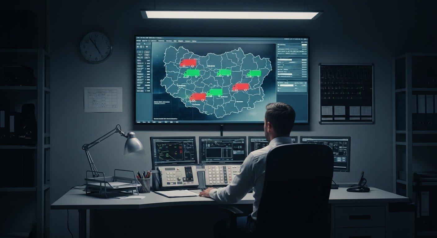
Les couches de trafic sont un élément essentiel des vues de carte GPS modernes, Offrir des informations en temps réel qui améliorent considérablement la navigation et la planification des voyages. En incorporant une couche de trafic, Les utilisateurs peuvent accéder aux informations importantes sur les problèmes de route actuels, embouteillage, accidents, et les zones de construction. Cette fonction s'avère particulièrement utile pour ceux qui utilisent un tracker GPS ou des applications comme l'application ProTrack365, permettant des choix de voyage éclairés.
Les informations derrière les couches de circulation découlent généralement de plusieurs ressources, composé de GPS indique des véhicules, Informations sur les applications mobiles, et informations rapportées par les autorités locales. Cet éventail varié d'informations aide à produire un résumé étendu des problèmes de trafic sur diverses voies. Le traitement de ces informations implique des formules avancées qui analysent les modèles et fournissent des estimations précises des temps de trajet en fonction de la circulation actuelle.
Parmi les avantages notables de l'utilisation d'une couche de trafic est sa capacité à minimiser le temps de trajet. Pour les circonstances, Lorsque les utilisateurs impliquent une superposition de trafic en ligne, Ils existent avec des itinéraires alternatifs qui peuvent conserver le temps en évitant les emplacements congestionnés. Cette capacité est particulièrement bénéfique tout au long des HR de voyage supérieur, où les problèmes de route peuvent changer rapidement. De plus, Avoir réellement l'accès à des mises à jour immédiates sur les événements de trafic via une couche de trafic permet aux utilisateurs de modifier rapidement leurs plans, finalement améliorer leur expérience de voyage.
L'intégration des couches de trafic non seulement aide à choisir l'un des itinéraires les plus efficaces, mais propose également d'améliorer la sécurité globale des voyages. L'exposition des informations en temps réel aide à atténuer l'impact des occasions inattendues sur l'itinéraire. Ainsi, pour les personnes qui cherchent à optimiser leurs voyages, Comprendre et utiliser les couches de trafic est essentiel.
Couches de vue sur la route: Explorer le degré de terrain
Road View Calques offre aux utilisateurs un point de vue unique en leur permettant d'explorer les emplacements au niveau du sol. Contrairement aux images satellites qui fournit une vue ci-dessus, Road View intègre des méthodes de photographie numérique panoramique pour produire des images immersives accessibles à travers divers systèmes de cartographie, Composé du système de surveillance GPS ProTrack. Ces visuels affichent des routes, structure, et des paysages comme si le spectateur se tenait à cet endroit, améliorant ainsi considérablement l'expérience utilisateur.
La capture d'images Road View est réalisée en utilisant un équipement spécifique, qui se compose souvent de cames vidéo haute résolution montées sur des véhicules qui traversent les communautés. Cette technique permet la collection de photos à 360 degrés, qui sont après cela cousu les uns avec les autres pour fournir une vue fluide. Comme la technologie a progressé, Certaines solutions ont élargi leurs capacités à composer des superpositions et des mises à jour du trafic en direct, Fournir aux utilisateurs des informations plus étendues et en temps réel sur leurs emplacements préférés.
Les applications pratiques de la vue sur la route sont variées et de grande envergure. En touriste, Les voyageurs potentiels peuvent explorer pratiquement les emplacements, Aide à la planification des voyages et au choix du site Web. De la même manière, Dans l'industrie du secteur immobilier, Les acheteurs potentiels peuvent utiliser des couches de vue sur la route pour enquêter sur les communautés et les maisons résidentielles ou commerciales sans avoir besoin de les visiter littéralement. Les entreprises locales bénéficient également; Ils peuvent utiliser Road View pour développer une présence en ligne, Aider à attirer des clients qui pourraient les trouver via un parcours sur Internet.
Cependant, Il y a des défis et des restrictions associées aux images de vue de la route. Problèmes d'intimité personnelle, précision d'information, Et le potentiel d'images obsolètes peut entraver l'efficacité de ces appareils. En plus, Alors que Road View est incroyablement bénéfique, Cela ne modifie pas l'exigence de visiter des emplacements réels pour une expérience directe. Alors que la technologie continue de se développer, Des systèmes comme l'application ProTrack365 peuvent améliorer la clarté et améliorer la régularité des couches de vue sur la route, Permettre aux utilisateurs un plus riche, compréhension plus détaillée de leur environnement.